
Areguling Beach
A few years ago when I wanted to go along the beach on the southern island of Lombok, especially the destination, I wanted to find out the beach objects that existed between Kuta Beach and Selong Belanak beach, which had been registered in my mind. I never know Areguling Beach.
I have to visit Mawun beach, which for decades I have gotten information about its beauty through tourism pamphlets or brochures, to be honest at that time I did not have a motorcycle, at that time, if I wanted a motorcycle, I had to buy cash or buy without credit, at that time almost all the people difficult to have a motorcycle if it is not helped by financing through credit or “finance”. OK, it seems like I want to have a motorcycle at that time.
After I could have a motorbike like people in general, with credit it seems like my curiosity will be answered, all of the newly opened lanes I followed were no exception to the path that goes from Kuta beach to Selong Belanak beach, the first time at that time I failed because there are improvements to the road from the direction of Kuta beach to Selong Belanak beach.
I saw a number of heavy equipment (excavators) on the hill dredging the ground in the area of Areguling beach, I could not pass because the road was made up of dusty soil and there were piles of unused leveled dirt and finally I turned back towards Kuta beach because my cousin that I was reluctant to also want to continue the journey because of the unfavorable terrain conditions, even though the motor we use a large CC with P220 type as I recall was in 2012.
A year later I tried again to cross the path I was referring to, but this time I entered through the Penujak village route just after the Penujak market about 100 meters there was a bridge with an Australian steel frame model, there was a lane to the right there was also a road map belonging to the Department of Transportation with an arrow reading “Belongak Belanak.”
Because these instructions I see too often when I go take tourists to Kuta beach (Areguling). This path was once the main route to Kuta beach before there was access to the supporting road to the direction of the Lombok International airport, I say for people who have recently visited Kuta beach this route might be unfamiliar to him.
From Penujak village to Selong Belanak beach at that time, it was still dominated by corn or tobacco plants, the condition of the asphalt road was good but it was bumpy because under the road there was clay so that there was a shift in the structure of the soil. I drive up and down, but not all such roads are only a few km (about 2 km)

Road conditions also go up and down but more likely to rise because we will go to the hill that appears on the mainland of the southern island of Lombok if the weather is sunny. Along the road there were no restaurants or even restaurants, unlike 2 days ago on October 15, 2017 we and the team explored had to stop by at Missile Meatballs and next to him there was a simple restaurant with a rather modern menu.
There have been a few changes in this path over time accordingly: Demands, Needs and Prospects will affect the movement of the local economy, many houses have also been seen with brick wall construction, small kiosks, motorcycle repair shops already exist in several places. we see on the side of the road.
Back to the beginning of the story until I approached the Selong Belanak beach until at the fork in the road if going to the right will go to the Selong Belanak beach and if turning left will lead to several beaches that become tourist destinations, including: Mawi beach, Semeti beach, beach Mawun, Areguling beach and up to Kuta beach. At that time I only knew he wanted to go to Mawun beach and at that time I had a chance to visit him.
After a few times I crossed this road, at that time there appeared a path to the hill that had just opened but at that time I was not interested in visiting it because it was still in the form of a dirt road with wet conditions, because at that time it was just pouring out and it seemed visible slippery and there are some lumps of soil not yet cleaned.
After a few more passes there are directions that read Areguling with arrows but have not been paved, in my mind I must explore in that direction because at that time I was with tourists and I was the guide, until this location I first saw in a post on Facebook, who posted is not friends with me but one of my friends was tagged and appeared on the homepage of one of my friends but I have forgotten the name of my friendship who was tagged because I was focused by paying attention to the pictures.
Until Sunday, October 15, 2017 I invite my friends NGELAMANG TRIP to come to this location (Areguling), before I have searched on google map and got two alternative paths, namely via the Penujak route or via the Tanak Awu line in front of the Lombok International Airport, the closest route is shown with the Tanak Awu route through the same village as the Penujak route but certainly the scenery is different, I prefer the path both so there is also knowledge for My Team.
Our first path went through the Penujak route in other words the main route to Selong Belanak beach until we reached the Areguling beach, we were both the first to enter this area, from the main route up to the top with pretty good asphalt road conditions which used to be just a road narrow land, after reaching the top there are also some residents living above, until the asphalt is cut in the village not to the edge of the beach and along the dirt track.
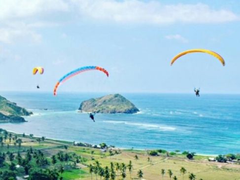
After entering the Areguling beach area I was a little confused I wanted to take it to where the first My Team, to the left or to the right up to the hill where there is a paragliding dive activity, but I chose just left according to my instinct to go to the rock cliffs that posted on Facebook first, if you go straight to the beach, you can see a car and motorcycle parking lot, and it looks like Mushalla is being built.
If you want to get in just for a short time, 1 motorbike can pay for parking 5,000 x 3, it is better to just turn left until the fishermen’s village, we stop for a moment to take pictures, it just so happens that there seems to be a Gili or a fairly large island with hilly contours, the person said called Gili Nusa and not too far from the beach, about 50 meters.
We also took photos to the left and right, the object was both the view of the cliff and after a couple of times when I looked down at the feet one of my friends was mining the sand, he said to make it to be placed at the bottom of the aquarium he said while putting sand grains in bottled 1500 ml bottled water, his sand was quite unique as in Mandalika Resort or in several other beaches such as Tanjung Aan beach, Seger beach, Semeti beach, Mawi beach and others because on the island of Lombok is very many places choose this form of sand.

The shape is like a roundabout of pepper also there is almost the same as pepper grains (varies) then after drinking our bottled water also feels fresh again and we proceed to the cliff that we mean, at that time there appeared to be 3 girls driving motorbikes to in the direction we are going, we are both giving light but they don’t go along the beach just taking pictures a few minutes later returning, we were too impatient to scoop up a cell phone camera before parking under a tree, we didn’t expect it to be a tree This is great for photo objects and we immediately act.
After completing our shelter we must immediately go explore to the coast and for motorcycle safety one of our friends must be prepared to sacrifice at the location where we parked the motorbike so that My Team is calm, it seems we find it difficult to walk quickly along this beach, eeeeiiittt … !!! for a while this was caused by too many good objects to take pictures so while walking while taking photos and finally we found fishermen’s hut exactly facing Gili Nusa.
It is said that Gili Nusa is being offered with a number of hectares of land, well the location is in the form of rocky hills and in the distance on the hill the traditional miners appear, also suitable if we look at the color of the rocks in front of us like the color of iron rust and the color of sand- here there are jet black and there are white sands separated, while stopping taking pictures well, we just enjoy this trip.
My Team see on Facebook: Iwan Keongracun, Tigor Jeeva, Qirin Rin and Supardani Dan
Until the second time we found a fisherman’s hut with a total of about 5 heads of families, we continued the journey until we found a towering rock as you can see in the cover picture above, the shape is very beautiful with whitish color, this is something I have never seen before , we were very comfortable in this place.
It seems that the water is receding maybe if the tide is likely our feet will be wet with a knee but unfortunately the time is not possible to linger in this last place also we cannot continue the journey to the next location and finally, let’s go home let’s go home together and finally around 18:00 we arrived at our respective homes.
