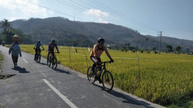
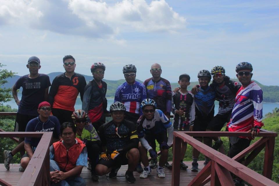
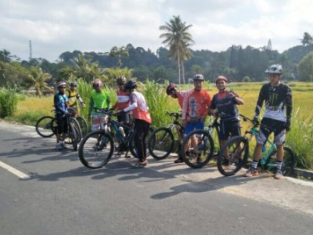
Jangan sekali-kali meremehkan KPK untuk urusan goes jauh, team ini sangat tangguh walaupun terdiri dari orang-orang yang sudah dikategorikan tua, namun tenaga dan spiritnya tak kalah dengan anak muda.
Kali ini saya akan bercerita tentang pengalaman KPK OTT (Operasi Tanjakan Tinggi) bersama KPK, tentunya anak muda harus iri dengan ketangguhan KPK, team KPK itu sendiri terdiri dari 4 orang yang sudah cukup berumur saya sebut saja orangnya: H. Hanafi (Ketua) pak Yasin (wakil) saya sendiri sebagai Sekretaris dan Mahmud Yunus sebagai Bendahara.
Team KPK OTT ke Kecamatan Sekotong
Saat memasuki desa Buwun Mas
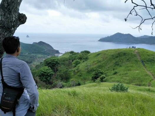
Penobatan kepengurusan KPK sesuai dengan uji kemampuan di tanjakan Jurang “Gerepek” yang tak jauh dari pelabuhan Lembar. OK Kita beralih ke pembahasan inti, team KPK yang di dampingi oleh goeser CSB (Campur Sari Bersepeda) ke rute kita kali ini untuk menuju pantai Mekaki.
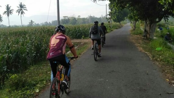
Kedua team ini berangkat dari kota Mataram, berkumpul di depan kantor bank BI cabang Mataram kemudian berangkat bersamaan melalui jalan Airlangga ke arah selatan menuju pelabuhan Lembar.
Team KPK Sarapan Sebelum Berangkat OTT
Setelah sampai di pelabuhan Lembar sebelum dermaga Ferry tepatnya di simpang tiga jalan yang menuju ke arah kecamatan Sekotong mereka sarapan bersama di sebuah warung sederhana sebelum melanjutkan perjalanan.
Team CSB terliaht lebih enerjik jika dibandingkan dengan team KPK
Selesai sarapan kedua team melanjutkan perjalanan menuju arah kecamatan Sekotong, kabupaten Lombok Barat, tantangan pertama yang mereka harus taklukkan adalah saat melintasi tanjakan jurang Gerepek, cukup tinggi, tanjakan Gerepek terdiri dari 3 kelok untuk harus sampai ke puncak jalan aspal.
Walaupun ada sebagian team KPK yang harus takluk dengan tanjakan ini tapi team CSB cukup mengakui ketangguhan team KPK karena jika dilihat dari umur mereka yang sudah tergolong tidak muda lagi.
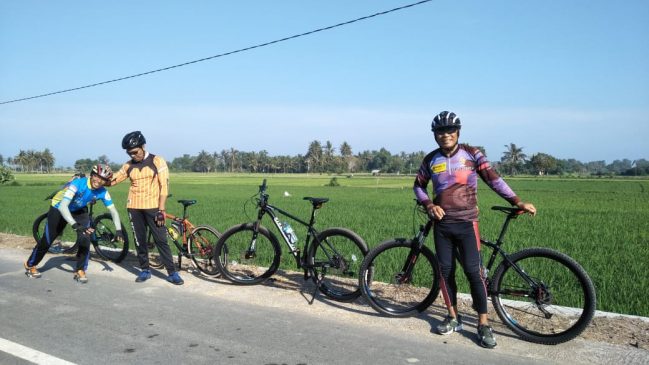
Total jumlah peserta yang ikut bisa anda hitung di sini
Selanjutnya setelah ke dua team tiba di kecamatan Sekotong Tengah, ada 2 pilihan jalur, yaitu jika berbelok ke arah kanan maka jalur ini biasanya untuk tujuan ke arah Bangko-Bangko.
Kesepakatan kedua team harus mengambil jalur kiri saja karena jalur ini sekalian bisa mampir di tujuan objek wisata savanna Buwun Mas yang baru-baru ini tersohor.
Tujuan Sampai di View Point Buwun Mas
Rute ini sangat teduh karena terdapat banyak pepohonan rindang, tapi cukup menghangatkan badan karena tak kalah banyak tanjakan yang harus dilalui juga. Dengan sedikit susah payah akhirnya kedua team sampai juga di view point Buwun Mas bagian bawah setelah mengayuh sepeda MTB sejauh 45 km.
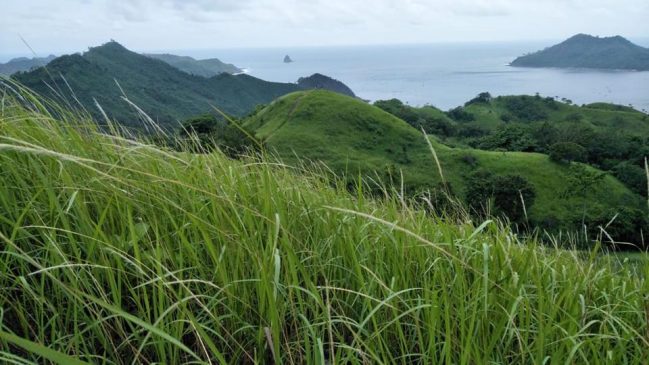
View poin yang di bawah lokasi savanna Buwun Mas tidak harus menguras tenaga karena jika kita menuju savanna Buwun Mas meski harus naik ke atas bukit, yang pasti kedua team tidak singgah di lokasi savanna Buwun Mas.
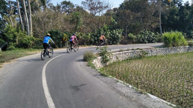
Sepanjang pejalanan kami menghadapi banyak tanjakan
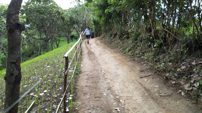
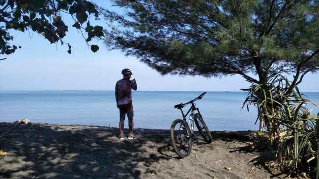
Selesai beristirahat, kami pun sepakat untuk melanjutkan perjalanan menuju pantai Mekaki yang berada di bagian barat.
Team KPK OTT sedikit terlihat ragu-ragu tapi harus berani menerima tantangan team CSB, tekad sudah terlanjur harus sampai di bukit Mekaki akhirnya kami berangkat juga yang diawali dengan medan turunan yang cukup menghibur.
Setelah itu sedikit demi sedikit beberapa tanjakan sudah memperlihatkan jati dirinya, hemmmm…!!! nasi sudah terlanjur menjadi bubur seperti itu juga terasa di pantat yang bagaikan terasa seperti sudah jadi bubur.
Cukup Melelahkan Melakukan OTT di Sini
Pak Yasin wakil ketua KPK
Sesi ini cukup melelahkan tetapi menyenangkan juga karena banyak panorama pantai yang sangat membuat hati kami kagum dan terasa damai, tekad pun harus bisa sampai di bukit Mekaki.
Jarak sudah tidak kami hiraukan yang ada dalam pikiran kami harus bisa menjumpai tempat-tempat yang indah untuk kita kenang nanti.
Team CSB yang sebelumnya terlebih dahulu pernah ke sini sangat menguatkan kami dengan semua cerita indahnya itu dan sangat membantu tenaga KPK yang sudah lemah menjadi kuat.
Team KPK benar benar ingin OTT di sini, dan bisa dibuktikan meskipun harus ada yang bantu dari belakang untuk mendorong hingga sampai di puncak jalan aspal yang menyuguhkan pemandangan alam yang menakjubkan.
Akhirnya Sampai di Bukit Mekaki
Walaupun tenaga sudah terkuras habis wajah kami harus tetap nampak bahagia
Terik matahari sangat terasa menghajar tapi tak ada alasan untuk harus menyerah, hingga pada akhirnya kedua team bisa sampai di bukit Mekaki.
Sambil menikmati keindahan pantai Mekaki dari atas permukaan jalan yang ada di puncak bukit. Target sudah tercapai, tenaga sudah terkuras, perjalanan pulang kita lanjutkan dengan muka-muka terlihat kusut.
Berhenti sejenak untuk makan siang di kota Pelangan, selanjutnya berangkat pulang sambil menyaksikan suasana matahari semakin redup menuju kegelapan malam dalam perjalanan.
Kedua team KPK dan CSB sukses menaklukkan tanjakan Mekaki walaupun terdapat banyak halangan dan ganjalan, karena 2 sepeda tidak bisa digunakan lagi karena rusak ringan.
Meskipun rusak ringan tetap saja tidak bisa kami gunakan, untunglah ada pengawalan 2 sepeda motor dalam penaklukan goes menuju Mekaki ini sehingga untuk urusan sepeda bisa terselamatkan tanpa ada kendala.
Aksi tangguh bapak ketua KPK (H. Hanafi)
KETERANGAN
KPK yang kami maksudkan di sini bukan “Komisi Pemberantasan Korupsi” tapi KPK di sini singkatan dari “Kelompok Para Kakek” dan OTT adalah “Operasi Tanjakan Tinggi.” Sekian semoga cerita goes kali ini bisa menginspirasi Anda semua. “Salam Olahraga”
Sebelum kita membahas pendakian Rinjani via Senaru alangkah baiknya kita harus mengenal dulu gunung Rinjani. Pendakian via Senaru paling umum digunakan oleh para pendaki, untuk melihat keindahan kawah yang paling sempurna.
SEKILAS TENTANG GUNUNG RINJANI
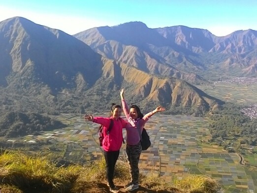
Kalau Anda seorang pendaki sejati pasti lah Anda akan kenal dengan gunung Rinjani, gunung yang terindah di Indonesia, oleh karena itu jangan sampai ketinggalan, mari kenali lebih dekat.
Yuk kunjungi gunung Rinjani, via Senaru dapatkan pengalaman yang terbaik dan yang terindah dalam pengalaman pendakian Anda.
Bila hendak mendaki gunung Rinjani bisa Anda lakukan melalui beberapa akses pendakian, diantara-Nya akses masuk: Rinjani via Senaru (Lombok Utara), Rinjani via Torean (Lombok Utara), Rinjani via Sembalun (Lombok Timur), Rinjani via Tete Batu (Lombok Timur), Rinjani via Aik Berik (Lombok Tengah) dan Rinjani via Timbanuh (Lombok Timur)
Pada umumnya kebanyakan pendaki melakukan pendakian melalui akses desa Senaru atau desa Sembalun Lawang.
Terutama bagi pendaki yang hanya ingin menaklukkan puncak Rinjani yang ketinggiannya 3.726 m dpl akses yang paling dekat adalah melalui Sembalun Lawang.
Jalur pendakian via Aik Berik kab. Lombok Tengah
Dalam jangka waktu dekat ini pemerintah kabupaten Lombok Tengah ada wacana untuk andil ambil bagian, terlibat dalam organize pendakian gunung Rinjani melalui kabupaten Lombok Tengah secara praktis.
Sebelumnya memang sudah ada tapi tidak seribut melalui jalur pendakian Senaru dan Sembalun yang berlokasi secara geografis berada di wilayah kabupaten Lombok Utara (Senaru) dan kabupaten Lombok Timur (Sembalun).
Rupanya Kabupaten Lombok Tengah juga tidak ingin menjadi penonton terus-menerus, hingga rencana ini akan diusahakan dengan konsep yang inovatif, dengan merencanakan pembuatan jalan atau pembukaan jalur baru.
Sehingga para pendaki sedapat mungkin bisa berkendara se-dekat mungkin di mulut kawah Segara Anak, karena ini adalah bagian dari alternatif bagi yang secara fisik sudah tidak kuat lagi melakukan pendakian dengan medan seperti jalur Senaru dan jalur Sembalun.
Danau Segara Anak melalui Pelawangan Aik Berik (sisi selatan kawah) kabupaten. Lombok Tengah
Sembalun adalah akses yang paling dekat untuk perjalanan menuju puncak. karena artinya Anda akan memulai pendakian dari ketinggian 1.156 m dpl.
Sementara pendakian melalui akses desa “Senaru” dimulai dari ketinggian 601 m dpl.
Gunung Rinjani adalah gunung vulkanik yang tertinggi nomor 2 di Indonesia setelah gunung Kerinci di Jambi (Sumatera) 3.805 m dpl.
Gunung Rinjani Meletus
Gunung Rinjani sudah beberapa kali meletus dan para ahli gunung berapi beranggapan bahwa gunung Rinjani dulu sebelum meletus ketinggiannya diperkirakan kira – kira 5.000 meter berbentuk kerucut, namun setelah dua kali mengalami erupsi besar hingga gunung ini membentuk kawah di tengah bekas letusan nya.
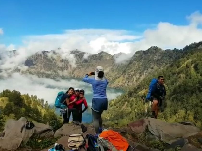
Seperti-halnya menyerupai mangkuk, mengakomodasi air hujan pada kawah nya yang terdapat di tengahnya danau air hujan yang disebut danau ‘Segara Anak’ yang berada pada elevasi ketinggian 2008 m dpl yang mempunyai luapan di bagian utara.
Air terjun Mangku sakti yang airnya berasal dari luapan danau Segara anak
Air luapan dari danau Segara Anak membentuk sungai kecil, airnya berwarna putih hingga orang lokal setempat memberi nama Kali ini dengan sebutan “kokok Putek.”
Dalam bahasa sasak yang artinya Kali putih, di mana aliran air yang berasal dari luapan danau Segara anak ini memunculkan banyak air terjun pada alirannya.
Di antaranya ada beberapa yang sedang populer untuk dikunjungi yaitu: Air terjun Mangku Sakti dan Air terjun Mayung Putek (rusa putih) dan air terjun Umar Maya.
Taman Nasional Gunung Rinjani (TNGR)
Taman nasional gunung Rinjani mulai dikembangkan menjadi industri pariwisata sejak tahun 1999 dan diikuti dengan terbentuknya lembaga RTMB (Rinjani Trekking Management Board) yang melatih dan mendidik seluruh komponen yang terlibat dalam organize pendakian gunung Rinjani.
Garis merah merupakan Rute Perjalanan pendakian Rinjani via Senaru
Gunung Rinjani pernah meletus untuk yang ke sekian kalinya pada tahun 2004, akibat letusan ini tidak ada efek yang diakibatkan hanya dentuman kecil yang terdengar hingga kota Mataram dan berpusat pada kerucut vulkanik yang terkurung oleh dinding-dinding kawah yang bertebing tinggi.
Terakhir kalinya meletus pada tanggal 3 November 2015 selama 2 minggu yang berakibat terganggu nya lalulintas penerbangan.
Terutama pada bandara internasional Ngurah Rai di Bali dan bandara internasional Lombok (BIL) karena efek dari hujan abu vulkanik yang ditiupkan ke udara hingga menghalangi jarak pandang untuk penerbangan.
Ironis nya bagi yang tinggal di sekitar lereng gunung Rinjani sama sekali tidak mendapatkan efek dari hujan debu hanya mereka yang paling jelas mendengar setiap dentuman saat terjadi erupsi.
Dampak Erupsi Rinjani
Gunung Baru Jari meletupkan abu vulkanik
Dampak meletusnya gunung Rinjani cukup memberikan efek terhadap para pelaku pariwisata yang sangat merasakan dampak dari bencana abu vulkanik erupsi gunung Baru Jari.
Banyak tamu-tamu travel agen dan tamu-tamu hotel membatalkan kedatangannya karena penerbangan untuk rute bandara internasional Ngurah Rai Denpasar (Bali) dan Bandara internasional Lombok (BIL) di tutup untuk sementara waktu.
Termasuk para pelaku bisnis pendakian gunung Rinjani, yang pasti juga para wisatawan yang sudah terlanjur membayar uang muka untuk penginapan hotel yang berlokasi di Lombok.
Gunung Rinjani via Senaru, terlihat bangunan para organizer pendakian.
Kawasan gunung Rinjani merupakan bagian dari taman nasional yang terdiri dari 40 taman nasional yang berada di nusantara yang meliputi luas kawasan 41.330 ha dan juga tergabung dalam hutan lindung dengan luas 66.000 ha.
Kelestarian hutan dan binatang yang terkandung di dalamnya dilindungi oleh negara, di sekitar lereng gunung Rinjani terdapat 20 desa tradisional yang mengelilinginya.
Kawah gunung Rinjani terbentuk sangat indah hingga banyak para penikmat gunung datang mengunjunginya, selain melihat alam yang mempesona para pendaki juga dapat melakukan kegiatan memancing di danau Segara Anak.
Ikan-ikan ini dulunya berasal dari benih yang ditabur oleh presiden Republik Indonesia yang kedua yaitu presiden Suharto.
Sampai sekarang ini berkembang biak hingga menjadi ukuran-ukuran besar terutama ikan mujair, para pendaki dengan sesuka hati bisa memancing di danau ini, tapi menurut keterangan dari para pemancing ikan-ikan yang terdapat di danau ini.
Sedikit berbeda dibanding dengan ikan yang umum didapat di air tawar yang berada di bawah yaitu ikan-ikan ini memiliki kepala sedikit lebih besar, mungkin akibat kekurangan asupan makanan hingga ikan-ikan yang terdapat di danau sangatlah lapar.
Para pemancing sangat mudah untuk mendapatkannya dan yang pasti ikan-ikan ini saat dimasak atau saat dihidangkan sedikit terasa bau belerang.
Anggapan Orang Lombok
Danau Segara Anak saat mendekati pos peristirahatan
Danau ini dinamakan danau Segara Anak oleh orang Lombok sudah bisa ditebak dari pemberian nama danau ini bahwa yang memberi nama adalah orang lokal (orang Lombok)
Pada zaman dulu orang Lombok apabila melihat air yang ter genang luas seperti-halnya saat melihat lautan mereka menyebutnya dengan sebutan “segara” begitu pula halnya dengan danau Segara Anak yang airnya menyerupai lautan kecil.
Orang Lombok menyebutnya segara, bisa jadi orang Lombok saat dulu melihat danau pada kawah gunung Rinjani ini menyerupai anak dari lautan hingga diberi nama anak lautan atau ”Segara Anak.”
Begitu juga halnya dengan kerucut vulkanik yang puncaknya ber elevasi 2.351 m dpl yang ada di pinggir danau, yang diberi nama Gunung Baru Jari atau Gunung Baru Jadi, karna orang Lombok dulu beranggapan kerucut vulkanik tersebut adalah gunung yang baru jadi atau baru muncul tanpa mereka tahu bahwa itu adalah efek geologi.
Diakibatkan tekanan magma yang mendorong permukaan bumi hingga berbentuk seperti kerucut, tanpa pernah tahu bahwa kawah itu bekas letusan pada masa lampau yang sangat dahsyat, secara umum 20 tahunan yang lalu orang Indonesia pernah mengenal gunung Rinjani lewat gambar pada uang kertas yang bernilai Rp 10.000.
Kegiatan Pendakian Gunung Rinjani Via Senaru
Camping side POS III via Sembalun
Untuk kegiatan pendakian gunung Rinjani sudah terorganisasi dengan baik di bawah naungan RTMB (Rinjani Trekking Management Board)
Organisasi ini memberdayakan penduduk setempat untuk terlibat menikmati anugerah keindahan Taman Nasional Gunung Rinjani yang diberikan Tuhan yang maha Esa bekerja sebagai organizer, pemandu wisata dan porter di sekitar desa Senaru dan Sembalun.
Mereka ini dilatih (para porter dan guide) cara-cara memperlakukan wisatawan selama dalam pendakian gunung Rinjani terutama cara memasak, membuat masakan ala Eropa.
Pendaki juga sebagian besar adalah (warga negara asing) para pelaku wisata pendakian gunung Rinjani dilatih cara-cara tindakan penyelamatan, melestarikan lingkungan dan alam sekitar, terutama menjaga kebersihan gunung Rinjani dari sampah terutama sampah plastik.
Buwun Mas is Lombok nice panorama like a spark of firecrackers in the ears of the local traveler today, how is that not what I like it. The village of Buwun Mas, located Lombok nice panorama in Sekotong Tengah sub-district, West Lombok district, is a place where green savanna is very pampering, so it is more complete, people call it more popular as “Savanna Buwun Mas”
Lombok Nice Panorama Buwun Mas Location
The Nambung coast line, when searching from Selong Belanak beach
Buwun Mas Village is no stranger to me because 3 years ago I crossed the path to this location but frankly for the Buwun Lombok nice panorama savanna location I did not know the exact location, when a friend of mine sent a Buwun Mas savanna picture via chat WhatsAap.
I just called his name bro Iwan then under the picture there is a chat, “Don’t know where is this location?
As soon as I click on the image that was shot on from the Instagram account then there appears the words Buwun Mas, Lombok nice panorama in Sekotong, West Lombok. I immediately answered that Buwun I know but regarding the location of the savanna in question I don’t know where the location is.
The end of a long conversation ended with the conclusion of Sunday, December 23, 2018 that we agreed to visit the Buwun Mas savanna location.
The Way To Lombok Nice Panorama Buwun Mas
Parking space in residential areas
The route to Buwun Mas can be accessed through 2 selected routes from the city of Mataram, this is what I know: The first alternative can be reached via the same route to the beach of Selong Belanak, before arriving at the Selong Belanak beach about 4 km before there is a junction with directions Pass to Selong Belanak and the lane turn right towards Sekotong, you have to follow the path that turns right towards Sekotong until the speedo motorbike shows the number 74 km then it will find the entrance to the Buwun Mas savanna.
Alternatively, you can travel to the two locations of Buwun Mas via Lembar Harbor in the direction of East Sekotong then at the T-junction of the city of East Sekotong sub-district, take the path to the Sepi highway until you show 49 km. You will find a land path going up to the right towards Buwun Mas savanna where Lombok nice panorama is here.
Savana Buwun Mas and Blongas bay in Sekotong Tengah sub-district
So if you drive from the direction of the city of Mataram as good as through the port sheet line this alternative is closer, so when we explore the location of Buwun Mas with Mas Iwan we trace it from the direction of Selong Belanak beach, because to my knowledge Buwun Mas is very close to Selong Belanak and it turns out The village of Buwun Mas is very wide including covering the hamlet of Nambung which is famous for its salty waterfalls or the beach of Nambung. We also had time to stop at Nambung beach but unfortunately because of the wave season and small winds we did not get the Nambung beach as we wanted.
Buwun Mas Savanna In Sekotong
The stretch of thatch at Buwun Mas savanna is soothing to the eyes
On the way to find the Buwun Mas savanna location, we kept asking anyone on the way until we found a signboard on the left side of the road with the writing TOURISM OBJECT OF BUILDING then I realized that if we knew the location here we would come through Lembar Harbor, and stupid again we don’t think about using the Google map application.
I just think about this location that has not been touched by tourists massively, as soon as we go to the parking lot it turns out visitors are like a market atmosphere.
After we parked the vehicle then walked up or climbed to the savanna location people went up and down with boisterous atmosphere, there were some visitors who were still desperate to ride using their motorbikes but I suggest that you don’t love the motorbike.
Select The Typical Motor Bike to Take The Hill
If your motorbike is trial type or type of off road is okay, just need to be careful at some points the terrain is very extreme or very heavy if you are not good at controlling a motorcycle.
The path goes up to the Buwun Mas savanna which is still OK for motorbikes
The journey will take about 30 minutes 2 km because the terrain is slippery, narrow and climbing, which surely you will arrive with sweat pouring, clothes wet with sweat, at the location there are impromptu traders using tarpaulin tents that sell bottled drinking water there are also those who sell Magnum class ice, there are also those who sell young coconut ice at a cheaper price compared to buying it in Mataram for Rp 5,000 but the portion is more expensive.
The appearance of visitors is very crowded if during the holiday season
This location is very wide, well it’s called savanna if you explore this location you can spend 2 km to find a good location for photo objects, I suggest if you arrive at the resting location just 15 minutes to lower your heartbeat while enjoying the charm of Buwun savanna Mas. It would be even better if you came to visit here by avoiding the holiday season or holiday, because if on holidays there were too many visitors who came to this location but another case if you like the crowd.
The other side of the Buwun Mas savanna
If you are not a Lombok person there will be questions in your heart about the meaning of the word Buwun Mas. Buwun means above and Mas means Gold is the literal meaning of this location or the content of this land contains Gold, this is not just a name in this location there are traditional gold mines which are located sporadically or mining excavation points separate.
There are some residents in When I asked Belongas Bay at a coffee shop about a luxury house in a remote village, he said that the luxury house belonged to a liquid gold owner or who succeeded in gaining gold mining around the hills in the village of Buwun Mas, so it was not just name but this region contains gold mining minerals.
No Signal for Mobile Phone Here
If the rainy season doesn’t forget to bring a raincoat
Besides that I can inform you at this location that there is no signal for cell phones, no rice stalls especially restaurants, no public toilets and no water sources, if there is oblique news about security to the location you should not be too trusting because the community the local people really do not like the assumption.
At least do not cross alone after night to keep the possibility that is not desired. Too bad our arrival at that time when it was cloudy so the sea water looked gray.
The sky was like that, when the rain fell there was no shelter at least you brought a raincoat made of crisp plastic bags that you can buy at Indomart or Alfamart. At that time I had asked since when was this location visited by many people to the people where we bought young coconut ice, he frowned slightly thinking a little longer, about 2 weeks ago but he denied again with the word “sorry” already 3 weeks ago sir, he said again.
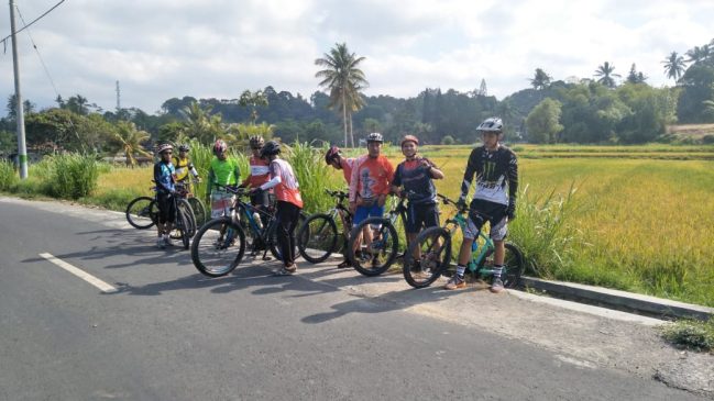
Lombok Cycling trip, lately cycling is very trendy to be used as a sport. Not only that, cycling has now become ten traveling by bicycle. in lombok cycling trips are in great demand. We are aware that most tourists in their hometowns have road bikes or MTB bicycles. Therefore they want to try the sensation of cycling while traveling.
PRICES ARE INCLUDED:
♥ MTB bikes (POLYGON PREMIER)
♥ Bicycle Helmet
♥ Entrance Tickets for Attractions
♥ Unlimited Bottled Water
♥ Lunch + fruits
♥ Pick Up Car Loading
♥ Guide
♥ Marshal (for group participants)
Cycling routes will be conditioned according to the physical abilities of the participants or can choose the route we have displayed on this page if it can be considered according to the information we wrote and in the implementation the participant must not be divided into several parts so that it is easy to control the guide and avoid missteps.
For equipment we only provide bicycles, helmets, Pick Up Loading cars for other purposes such as carrying spare bikes and other logistics.
Other equipment is the initiative of the participants because this is a relaxing and relaxing event while traveling. Minimum of 5 participants if there will be less other things that must be taken into account. In this adventure trip package.
We illustrate the location of departure from the city of Mataram, of course, for a very flexible start location that you can request from anywhere, especially from the Senggigi area, Kuta beach, Bangsal Port and others because the location of the hotel where you stay is very large for tourists.
Hills view on Bengkaung hill, Batu Layar sub-district
The route not far from the city of Mataram we will go to Gunung Sari sub-district West Lombok regency exactly in the hills that appear to the north of the city of Mataram in this location the terrain is very Extreme but not too long about 5 km with up and down, part of the Asphalt road.
Above hill construction road rebates 1 meter wide, some there are dirt roads when descending from the hill towards Batu Layar but not too long about 1 km very nice natural scenery from the hill can see Ampenan coast and Bengkaug valley.
Always green with coconut plantations which dominates on the hill besides the Aren tree the route length is about 30 km suitable for beginners but must have a lot of rest and carrying a bicycle participants are encouraged to be careful especially when coming down from the hill because the terrain is very steep and will be slippery after rain. 4-hour normal travel time includes resting while taking photos.
Mataram – Bukit Tinggi Village – Batu Kemalik – Tibu Tereng (35 km)
Batu Kemalik water park just in the north of Mataram City
The route not far from the city of Mataram we will go to Gunung Sari sub-district West Lombok regency exactly in the hills that appear on the north side of the city of Mataram in this extreme terrain with asphalt conditions that are quite friendly about 70% with climbing terrain starting from Penimbung village to Batu Kemalik The asphalt road will be cut off but before we pause in the village of Bukit Tinggi to see the scenery of the western hills.
We can still see the city of Mataram hopefully the gate to this location is open because it is often covered by private land Villa building owned by former Mayor of Mataram, Drs. M. Ruslan whose construction, was stopped was not big enough but this land was very suitable for a place to relax while enjoying the hilltop if it was not foggy.
The remaining 30% of the condition is a 1 meter wide rebate road and the dirt road up to the top of the hill falls a little further to reach the upstream direction of the river until finally we arrive at Tibu Tereng for bathing or bathing for those who want. Throughout our journey we will traverse the atmosphere of the garden, the houses of the residents, with our 2 notes & position on the ridge.
The incline is so constant that at the end of our journey we will feel very high after seeing a very deep valley from the top of the hill. km is suitable for beginners but must be extra patient to arrive at the destination, an estimated normal journey of 4 hours while relaxing.
Mataram – Timponan Lingsar Waterfall (50 km)
Timponan waterfall in Lingsar west of Lombok
The route to the village of Lingsar from the direction of the city of Mataram to the east towards the Lingsar sub-district crosses Buk-Buk village, Peteluan Indah village, Batu Kumbung village after turning left to the north again we will cross the village of Batu Mekar, 60% of the asphalt road rather flat 10 % of the rebate road is some steep, 20% of the dirt road is climbing.
The terrain is very shady because we will cross a very fertile plantation, the road is very narrow often happens if there are people who bring bananas out of the garden we must yield to pull over.
At the end of the trip we have to park bicycles and walk to the Timponan waterfall as far as 700 meters. The location of the waterfall does not allow us to bring the bike to the location of the waterfall because the path that passes through the bush and the walls of the land is difficult.
Estimated total routes of 50 km are not recommended for beginners because there are several times travelers have tried and had to turn around again but this might be because it’s just not used to it.
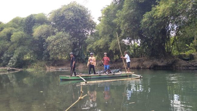
If you want to diversify by trying white water rafting on the river Jangkuk is very suitable and fix we will spend one day for biking and rafting but for the cost of rafting there is an additional Rp 200,000 / person the length of the river that we pass for rafting is about 7 km there are 5 rapids and will be carried upstream with a 25-minute off road car.
Mataram – Malimbu Beach (40 km)
Relling view point on Malimbu Hill
The route to the west coast direction of the island of Lombok crosses the city of Ampenan, Batulayar, Senggigi, to Malimbu beach which enters the North Lombok regency 100% smooth asphalt road.
A little crowded traffic but don’t worry the road on this track is quite wide 2 notes & we cycle along the beach very beautiful, lots of climbs that are high enough before arriving and arriving at Malimbu hill lunch at Nipah beach with a menu of grilled fish will add to the relaxing atmosphere.
On the way we will stop at several view point locations of course because this destination is relaxed and not racing but it’s up to you if you want to ignore the view point that we mean is also not a problem.
First view point where we will stop in front of Batulayar tomb with a view of Batu Bolong and Senggigi beach to the left we can see Ampenan beach with the characteristic of Pertamina oil refinery.
Then we will stop above the Sheraton Senggigi hotel for to see the bay of Senggigi beach with a view of the fast boat harbor for the purpose of the island of Gili Trawangan and the island of Bali.
Then we stop at the view point at the Ghost Villa located on the Kelui beach 1 km before arriving at Malimbu beach. if it is still strong we can continue the journey to the coast of Malacca because there are still many better view points.
It means that our journey increases by 15 km is no problem for beginners just maybe have to patiently carry a bicycle on each incline because there are quite a few inclines near Catamaran hotel location before arriving at the border monument between West Lombok and North Lombok.
Just down to the left on the left side there is a Jeeva Kelui hotel that has entered the North Lombok regency then climb before the ghost Villa and if we proceed to the Malacca coast then we will cross 2 higher inclines.
Than we have mentioned until arriving at the Malacca coast we go down a bit to take pictures to take pictures of Nipah bay with a total journey of 40 km plus 15 km if our 2 notes & arrive at Malacca beach for beginners can also but must struggle to push bicycles on some climb.
Mataram – Narmada – Lingsar – Gunung Sari (45 km)
Wellcome rapids at the Kali Jangkuk of Batu Mekar village in Lingsar sub-district
The route from Mataram city to Lingsar sub-district West Lombok regency 100% asphalt road 40% of trips across the busy traffic lanes of the province 50% of the village lanes with rice fields.
Gardens are very cool to ride bicycles because of shady trees all the way across several villages in Lingsar sub-district this, the remaining 10% of the road is busy when returning home to the direction of the city of Mataram.
If you want to make variations this 2 notes & can be combined with rafting in Batu Mekar with a total time we have to set aside 3 hours but there will be an additional fee of Rp 200,000 / person for rafting trips or rafting is no problem for beginners I even say it is suitable for beginners the total trip is approximately 45 km
Mataram – Lingsar – Suranadi – Sesaot (55 km)
Aik Nyet forest park
80% of the asphalt road route from Mataram to the northern ring road towards the intersection of the Soul Hospital in Selagalas then from the intersection we turn left to the east towards Batu Kumbung village, Lingsar Subdistrict.
After arriving at Batu Kumbung intersection we turn right towards the direction Narmada city park on the side there are 2 lanes to Suranadi but we take the second corner because we will take a more lonely lane than that.
This pathway looks more rice fields, but before we will cross the village after that the plots of rice fields will welcome our mood becomes more harmonious.
Before arriving at the Suranadi tourist park the atmosphere of the tropical forest is very indulgent for our journey because almost all the asphalt roads are covered in trees.
Before arriving at the Sesaot forest the asphalt trip will turn towards the Japanese-owned Rinjani Golf Kosaido but we don’t go here down left irrigation with solid land conditions so that later we will come out on the asphalt road to the Aik Nyet tourist park Sesaot forest about 2 km again arrived at the welcome gate on the left side of the road.
There is a bridge not far from the main road we will enter Sesaot tourism forest and if we go straight to the asphalt road the trip will penetrate to the provincial road in Kekeru village, Central Lombok district.
From the bridge we will paddle the bicycle across the village with damaged asphalt road conditions then the wet road to the Aik Nyet tourist park or in Lombok language Arik Aik is water and Nyet means cold like that if anyone wants to soak in a cold river you can do it here.
This route is suitable for beginners but many have to stop taking photos and while taking a breath too.
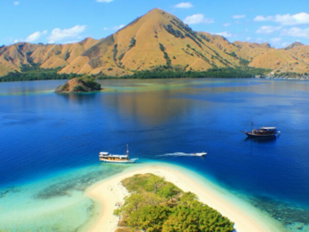
Mataram – Sheets – Sekotong Beach (135 km)
Gowes to Sekotong beach sore
The route to Sekotong beach in Sekobar sub-district or Sekotong Barat district of West Lombok 100% of the good asphalt road from Mataram to the port Sheet traffic is 25 km long and quiet road with lonely traffic is very cool because of the beautiful and visible Gili coast.
Gili which is a tourist destination, which includes Gili Sudak, Gili Tangkong and Gili Nangggu or another name, “Gita Nada” besides that there are other Gili-Gili like Gili Turtle, Gili Lontar, Gili Poh, Gili Gede and temporary The other Gili is not visible behind Gili Gede, the beach is not visible, but we will continue to visit the Mekakai beach from the beach to the beach. for beginners Because it is quite far estimated 135 km
Mataram – Benang Kelambu Waterfall (75 km)
Some stairs at the location of the waterfall will be a challenge for visitors
The route to Central Lombok regency is 97% slippery asphalt, the remaining 3% of the road is the middle of the axis of the island of Lombok, but before we will ride the traffic until at the Pancordao T-junction we will start freely because the trip is very quiet at the T-junction of Teratak market.
We turn left again across the beautiful rice fields and it will be very perfect again after the return to the city of Mataram without being shaken we can arrive at the city of Chakra.
There are only 2 places that have to be installed in Kekeru and Tanak. with a lot of water from the plantation to the parking lot Bicycles at the waterfall gate The participants can go down take a bath in a very clean and cold water area.
Before returning to the parking lot, 75% crossing the very crowded lanes and 30% traveling crossing the quiet lane but half the terrain is climbing, it is not recommended for beginners, the total trip is approximately 70 k
Mataram – Tanjung – Tiu Teja Waterfall (145 km)
Tiu Teja waterfall in north of Lombok
From the city to Gunung Sari sub-district then through the pass through many terrain terrain until it reaches 600 m above sea level after that we descend towards Winners district for 15 km without shaking bikes except in Bentek hamlet there are few climb then we will go right to the intersection.
Winner we turn right because we will go to the ferry to Gili Trawangan, the port of Bangsal, then we will cross the Tanjung sub-district of North Lombok regency continue across Gangga sub-district.
There was a wide-open road until it arrived at Santong T-junction the journey had reached 60 km then we turned right with the terrain uphill as far as 13 km until at the waterfall parking location 98% the asphalt track was good.
There was a 2% dirt road with a little rock field where the rebate climbs across the garden goes to the waterfall Tiu Teja lottery, not r ecommended for beginners, this terrain is suitable for those who are used to 2 notes & long distance trips 145 km
Mataram – Kuta Beach – Bukit Merese (120 km)
Me on Merese hill in south of Lombok
The route from Mataram to the south coast by taking the route to the direction of Lombok International Airport (BIL) is across one-way construction that is very good because it is connected to the main road of Lombok.
The road to the airport so when people outside the new area arrive to Lombok the road will be the first to be seen, after crossing in front of the airport we will continue to the south coast to Kuta beach as far as 20 km participants can take a short break to take pictures in the Mandalika Resort area, before we continue our trip to Tanjung Aan.
2 notes: Notes up the hill Merese about 4 miles east of the hill Merese before going down again down if we are physically fit to travel we can do it with different paths to the beach but if we don’t just go back through the same route with terrain flats.
This route, 95% of the notes and ride will be present as well as the road will be smooth and beautiful. the smooth asphalt road, this 2 notes and the route is not recommended for beginners. there is very little hiking field around 7 km before arriving at Kuta beach and there are some before mas
Around Lombok Sembalun Route 2D / 1N (212 km)
Pusuk Pass Sembalun at an altitude of 1,600 meters above sea level
The route is 100% asphalt road, from the city of Mataram we will travel as far as 97 km to arrive at Sembalun Bumbung, the journey from the city of Mataram across the traffic is very crowded two lanes but the width of the road is very adequate.
Wherever possible we leave very early because the terrain is not only because far but from the city of Mataram to the sub-district of Mantang the road does not feel uphill as far as 28 km after the road goes up and up at the intersection of the sub-district of Aikmel.
Heading to the summit of Sembalun medan is very extreme because we will conquer an altitude of 1,600 m above sea level and we will arrive at 4 pm Sembalun sub-district, East Lombok district and stay at Sembalun Lawang.
Next the second day we continue the journey to Mataram via North Lombok and along the north and west side of the island of Lombok, the route will be 115 km longer to Sampai in the city of Mataram but the terrain is lighter.
There are only 3 heavy zones including the slope, two climbs in Sambi Elen, Batu Gerantung and several inclines in Pusuk, the total trip is estimated as far as 212 km suitable for enthusiast 2 notes & is not recommended for beginners.
Savanna Buwun Mas bagaikan percikan petasan di telinga para traveler lokal saat ini, bagaimana tidak seperti itulah saya ibaratkan nya. Desa Buwun Mas yang berlokasi di kecamatan Sekotong Tengah, kabupaten Lombok Barat.
Ini adalah tempat berlokasi nya savanna hijau yang sangat memanjakan mata, jadi lebih lengkapnya nya orang-orang menyebutnya lebih populer dengan sebutan “Savanna Buwun Mas”
Jalur pantai Nambung, ketika menelusuri dari pantai Selong Belanak
Desa Buwun Mas tidak asing bagi saya karena 3 tahun yang lalu pernah saya melintasi jalur menuju lokasi ini tapi terus terang untuk lokasi savanna Buwun Mas saya tidak tahu lokasi persis nya.
Ketika seorang teman saya mengirimkan gambar savanna Buwun Mas melalui chat WhatsAap, saya sebut saja namanya mas Iwan kemudian di bawah gambar ada chat, “Tau tidak di mana lokasi ini ?
Begitu saya klik gambar yang di screen shoot dari akun Instagram lalu ada muncul tulisan savanna Buwun Mas, Sekotong, Lombok Barat. Saya langsung jawab kalau Buwun Mas saya tau tapi mengenai lokasi savanna yang dimaksud saya tidak tau persisi di mana letak lokasinya.
Akhirnya percakapan panjang pun berakhir dengan kesimpulan hari minggu tanggal 23 Desember 2018 kami sepakat akan mengunjungi lokasi savanna Buwun Mas.
Tempat parkir di pemukiman penduduk
Jalur menuju savanna Buwun Mas dapat di akses melalui 2 jalur pilihan dari kota Mataram, ini yang saya tau: Alternatif pertama dapat ditempuh melalui jalur yang sama menuju pantai Selong Belanak, sebelum tiba di pantai Selong Belanak kira-kira 4 km sebelumnya ada pertigaan dengan petunjuk arah Lolos ke Selong Belanak dan jalur belok kanan menuju Sekotong.
Anda harus mengikuti jalur yang belok kanan menuju Sekotong hingga speedo motor menunjukkan angka 74 km barulah akan menjumpai jalan masuk menuju savanna Buwun Mas.
Alternatif ke dua lokasi Buwun Mas dapat Anda tempuh melalui pelabuhan Lembar ke arah Sekotong Timur kemudian di pertigaan kota kecamatan Sekotong Timur ambil jalur menuju jalan raya Sepi hingga km menunjukkan 49 km Anda akan menemukan jalur tanah menanjak ke arah kanan menuju lokasi savanna Buwun Mas.
Savana Buwun Mas dan teluk Blongas di kecamatan Sekotong Tengah
Jadi jika Anda berkendara dari arah kota Mataram sebaiknya melalui jalur pelabuhan Lembar ini alternatif yang lebih dekat, jadi saat kami menelusuri lokasi Buwun Mas bersama mas Iwan kami menelusuri nya dari arah pantai Selong Belanak.
Setahu saya Buwun Mas sangat dekat dari Selong Belanak dan ternyata desa Buwun Mas itu sangat Luas termasuk meliputi dusun Nambung yang terkenal dengan air terjun asinnya itu atau pantai Nambung.
Kami pun sempat mampir di pantai Nambung tapi sayang karena musim gelombang dan angin kecil kami tidak mendapatkan air terjun asin pantai Nambung seperti yang kami inginkan.
Hamparan ilalang di savanna Buwun Mas sangat menyejukkan mata
Dalam perjalanan mencari lokasi savanna Buwun Mas kami terus menanyakan kepada siapa saja dalam perjalanan sampai kami menemukan papan nama di pinggir jalan sebelah kiri dengan tulisan OBJEK WISATA BUWUN MAS
Barulah saya sadar jika kita tahu lokasinya di sini pasti kita akan datang melalui pelabuhan Lembar, dan bodohnya lagi kami tidak berfikir untuk memanfaatkan aplikasi Google map.
Saya hanya berfikir tentang lokasi ini belum terjamah oleh wisatawan secara massif, begitu kami menuju tempat parkir ternyata pengunjung bagaikan pada suasana pasar.
Tempat yang asik buat meratapi nasib
Setelah kami memarkir kendaraan lalu jalan naik atau mendaki menuju lokasi savanna orang orang lalu-lalang naik turun dengan suasana riuh.
Ada sebagian pengunjung tetap nekat naik menggunakan sepeda motornya tapi saya sarankan sebaiknya jangan jika sayang dengan motor.
Jika motor Anda dengan tipe trial atau tipe off road ya tidak apa-apa, hanya perlu berhati hati di beberapa titik medan nya sangat eks trim atau sangat berat jika Anda tidak lihai mengendalikan sepeda motor.
Jalur naik menuju savana Buwun Mas yang masih OK lah buat sepeda motor
Perjalanan akan memakan waktu kira-kira 30 menit sejauh 2 km karena medan yang licin, sempit dan mendaki, yang pasti Anda akan tiba dengan keringat yang bercucuran, baju basah oleh keringat.
Di lokasi ada pedagang dadakan dengan menggunakan tenda terpal yang menjual air minum botol kemasan, ada juga yang menjual es sekelas Magnum, ada juga yang menjual es kelapa muda dengan harga lebih murah jika dibandingkan dengan membelinya di kota Mataram seharga Rp 5.000 tapi porsi nya lebih banyak.
Penampakan pengunjung sangat ramai jika pada musim liburan
Lokasi ini sangat luas, yah kan namanya juga savanna jika explorer lokasi ini Anda bisa mengeluyur sejauh 2 km untuk mencari tempat lokasi objek foto yang bagus.
Saya sarankan jika tiba di lokasi istirahat dulu sekedar 15 menit untuk menurunkan detak jantung sambil menikmati pesona alam savanna Buwun Mas.
Alangkah lebih bagus lagi jika Anda datang berkunjung ke sini dengan menghindari musim liburan atau hari libur, karena jika pada hari libur terlalu banyak pengunjung yang datang ke lokasi ini tapi lain halnya jika Anda suka dengan keramaian.
Sisi lain dari savana Buwun Mas Iwan
Jika Anda bukan orang Lombok pasti akan ada pertanyaan dalam hati mengenai arti dari kata Buwun Mas.
Buwun artinya atas dan Mas artinya Emas jadi makna harfiah nya lokasi ini atau kandungan tanah ini mengandung Emas, ini bukan sekedar nama memang di lokasi ini ada tambang emas tradisional yang berlokasi secara sporadis atau titik-titik penggalian tambangnya secara terpisah.
Ada beberapa warga yang di teluk Belongas ketika saya tanyakan di warung kopi mengenai rumah mewah di dusun terpencil itu dia bilang kalau rumah mewah itu adalah milik juragan emas yang cair atau yang sukses mendulang hasil tambang emas di sekitar bukit-bukit yang terdapat di wilayah desa Buwun Mas, jadi bukan sekedar nama tapi kawasan ini mengandung mineral tambang emas.
Jika musim hujan jangan lupa bawa jas hujan ya
Selain itu yang bisa saya informasi kan di lokasi ini bahwa, tidak ada sinyal untuk telepon seluler, tidak ada warung nasi apalagi restaurant, tidak ada toilet umum dan tidak ada sumber air.
Jika ada kabar miring tentang keamanan menuju lokasi, sebaiknya Anda jangan terlalu percaya karena masyarakat setempat sangat tidak suka dengan anggapan itu, setidaknya jangan melintas sendirian setelah malam hari untuk menjaga kemungkinan yang tidak diinginkan.
Sayang sekali kedatangan kami saat itu pas lagi mendung, jadi air laut tampak abu-abu, langit pun begitu, ketikan hujan turun tidak ada tempat berteduh setidaknya Anda membawa jas hujan berbahan kantong plastik keresek yang dapat Anda beli di Indomart atau Alfamart.
Saat itu sempat saya tanyakan sejak kapan lokasi ini dikunjungi banyak orang kepada orang tempat kami membeli Es Kelapa muda, dia sedikit mengernyitkan kening berpikir agak lama, kira-kira 2 minggu yang lalu tapi dia bantah lagi dengan kata “maaf” sudah 3 minggu yang lalu pak katanya lagi.


 Kalau Anda seorang pendaki sejati pasti lah Anda akan kenal dengan gunung Rinjani, gunung yang terindah di Indonesia, oleh karena itu jangan sampai ketinggalan, mari kenali lebih dekat.